Shootway Map Desktop Site
Shootway Map is a presentation that plots the shooting locations and directions on a map by arrows associating numbering markers with the photos.
Ise Grand Shrine, Naiku and vicinity (January 2026)
Shinjuku station west side under construction (February 2026)
*Download may take some time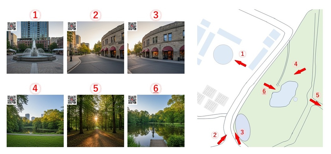
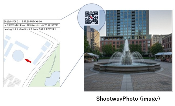
Shootway Photo contains various information (date/time, location, direction, etc.) embedded in the QR code* and is the main component to create Shootway Map.
*QR Code is a registered trademark of DENSO WAVE INCORPORATED.